

Crime Data Analysis
2018 / Tags: python, machine-learning, neural-networks, jupyter, map-apis
A machine learning project that analyzes crime data using Self-Organizing Maps (SOM) to identify patterns and visualize crime hotspots on interactive geographical maps.
Overview
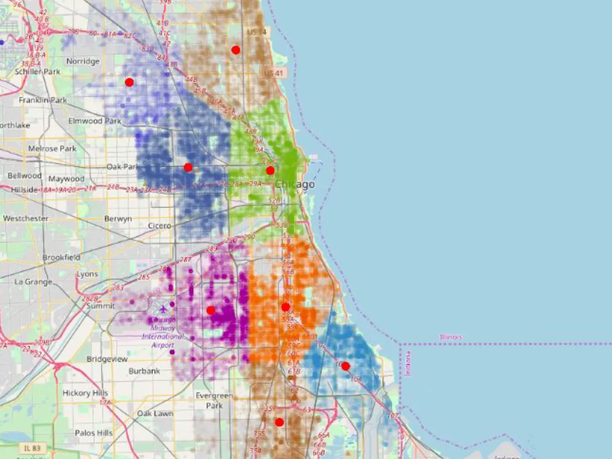
This project processes scattered crime data, clusters it based on geographic density and coordinates, and visualizes the results on an OpenStreetMap interface, making crime patterns easily interpretable.
Key Features
- SOM Clustering: Uses Kohonen Neural Networks to cluster crime data intelligently
- Density Analysis: Groups crimes based on geographical proximity and frequency
- Interactive Visualization: Displays clusters and centroids on OpenStreetMap
- Pattern Recognition: Identifies crime hotspots and patterns automatically
- Heatmap Generation: Visual representation of crime intensity across regions
Algorithm
Self-Organizing Map (Kohonen Network)
The SOM algorithm is an unsupervised learning technique that:
- Takes raw crime coordinates and metadata
- Discovers natural groupings in the data
- Preserves topological properties of the input space
- Produces intuitive cluster centroids
This approach is ideal for geographical data as it maintains spatial relationships while reducing complexity.
Implementation
- Data Processing: Python for data cleaning and preprocessing
- Clustering: Custom SOM implementation with adjustable parameters
- Visualization: OpenStreetMap integration with heatmap overlays
- Analysis: Statistical analysis of cluster characteristics
Tech Stack
- Language: Python
- ML: Custom SOM/Kohonen Network implementation
- Visualization: Jupyter Notebook, Matplotlib, Folium
- Mapping: OpenStreetMap API
- Data: CSV crime datasets with coordinates
Applications
- Law Enforcement: Identify high-crime areas for patrol allocation
- Urban Planning: Inform safety infrastructure decisions
- Research: Understand crime distribution patterns
- Policy Making: Data-driven crime prevention strategies
Results
The system successfully:
- Clusters thousands of crime incidents into meaningful geographic regions
- Identifies crime hotspots with centroid accuracy
- Provides interactive visualizations for stakeholder analysis
- Reduces complex crime data into actionable insights
This project demonstrates the application of neural networks to real-world geographical problems, combining machine learning with spatial analysis.
← Back to projects